

Broken Bow • Hochatown • Beavers Bend
Find local places for your Oklahoma trip
Search restaurants, cabins, activities, and local services.
📱 Take us with you — free app
Areas to Explore
Select an area of the map to see everything there.Hover or click an area to see what's there. Click it again to see every place.
🛏️ Places to stay
Cabins and hotels on the map
Cabins, lake houses and hotels around Hochatown, Broken Bow and Beavers Bend, with prices. Add your dates to see what's open. All places to stay →
Tap a price to see photos and book. We may earn a small commission if you book. It doesn't change your price.
About the area
Explore the Broken Bow & Hochatown area
Broken Bow and Hochatown sit in McCurtain County, in the far southeast corner of Oklahoma. Arkansas is to the east. Texas is to the south, across the Red River. The county covers about 1,900 square miles, making it the third-largest county in the state. It had 30,814 people in the 2020 census.
The land changes as you head south. The north is rugged Ouachita Mountain foothills. The south flattens out into the Red River valley. In between are a big lake, a cold trout river, a state park and small towns with deep Choctaw and timber roots. Tap an area on the map above for a quick look, or read on for the full story.
Broken Bow
Broken Bow is the area's hometown. It had 4,228 people in the 2020 census. U.S. 70 and U.S. 259 both run through town, so most drives into the area pass through here on the way north to the lake.
A town built on timber
The name does not come from a local Native word. It comes from Broken Bow, Nebraska, where the Dierks family ran a lumberyard in the 1880s. Around 1900 the family business moved south and bought large tracts of timber. Its Choctaw Lumber Company founded Broken Bow. The town became official, and its post office opened, on September 23, 1911.
The town was laid out at the east end of the company's railroad, the Texas, Oklahoma and Eastern. Homes, schools, churches and stores went north of the tracks. The mill and company houses went south. The company paid for a doctor and built a hospital that was open to anyone who needed care. By 1920 the town had 1,983 people.
In 1919 the company said in public that it would manage its land so a second crop of trees could grow. The family company was sold in 1969, but its mark is still here, from Dierks Street to Dierks Elementary School. The city also keeps Dierks steam engine No. 227, built in 1927. Timber is still an important part of the county's economy.
Plan a day in town with our Broken Bow activities and attractions page and our Broken Bow restaurants list.
Hochatown
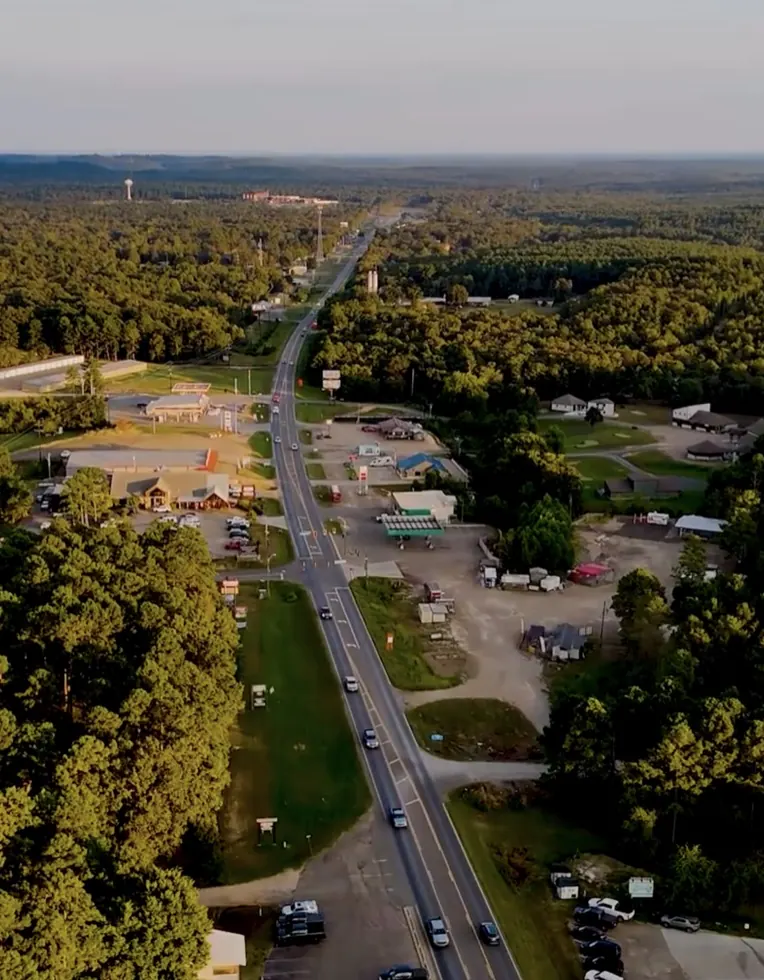
Hochatown is about 9 miles north of Broken Bow on U.S. 259, close to Broken Bow Lake and Beavers Bend State Park.
Deep roots
An Oklahoma Historical Society marker on U.S. 259 tells the story. Hunters left spear points along the Mountain Fork River here around 6000 B.C. Caddo people lived in the area from about A.D. 1000 to 1791. In the 1830s, Choctaw families made new homes along the river after their forced removal on the Trail of Tears. The town is named for a Choctaw man, Hocha, who arrived in 1833. A post office opened in 1894, and at its peak it served 175 families.
The town under the lake
In the 1960s the federal government moved families out so Broken Bow Lake could be built. The old townsite now lies under the water. The church and cemetery were moved west to U.S. 259, and the community slowly rebuilt near the new lake.
A new town
Residents worked for about 30 years to make Hochatown an official town. On November 8, 2022, voters said yes, 129 to 18, and county commissioners made it official that month. The town has since started its own police and fire departments.
The 2020 census counted 242 people in Hochatown. Visitors far outnumber them. A 2026 news report counted about 3,300 active listings on just one big vacation rental website, and the town says lodging taxes bring in nearly half of its revenue. Hochatown has no ZIP code of its own, so it shares Broken Bow's 74728. The state has been widening U.S. 259 through town since late 2024, so watch for work zones.
Just off U.S. 259 on OK-259A is Choctaw Landing, a 100-room Choctaw Nation resort that opened in April 2024.
See our Hochatown activities and attractions page and our Hochatown restaurants list.
Beavers Bend State Park
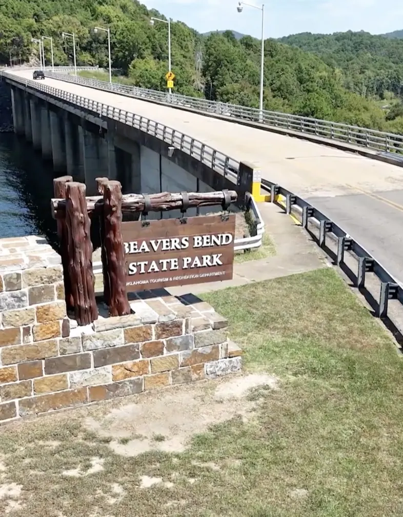
Beavers Bend State Park covers 3,482 acres of pine hills on the shores of Broken Bow Lake and the Mountain Fork River. It is about 10 miles north of Broken Bow. The park office is at 4350 S Hwy 259A (580-494-6300).
Built in the Great Depression
Beavers Bend was one of Oklahoma's first state parks. Civilian Conservation Corps Company 2815, part of a Great Depression jobs program, built it between 1935 and 1941. It opened as a state park in 1937. The name comes from John T. Beavers, a citizen of the Choctaw Nation who owned part of the land, and from a bend where the river makes a near U-turn.
Stay and play
The park has 47 cabins with kitchenettes and 393 campsites spread over eight camping areas. Two yurts, round tent-like shelters, sit near the river. Beavers Bend Lodge stands on the lake shore, and every room looks out on the water.
By day you can hike, bike, paddle the river, ride horses or fish. A naturalist runs nature center programs all year. The park also has mini-golf, tennis, an amphitheater and the 18-hole Cedar Creek Golf Course.
On a rainy day, visit the Forest Heritage Center, a free state museum inside the park. Its 14 large painted scenes, called dioramas, are the work of Harry Rossoll, the Smokey Bear artist. They tell the forest's story, from prehistoric times to the Caddo people to 1940s logging.
Parking
Beavers Bend charges a daily parking fee for each vehicle, with a lower rate for Oklahoma and tribal plates. Any cabin, lodge or campsite booking comes with one parking pass. Check current fees before you go.
For lodging, trails and family tips, see our Beavers Bend State Park visitor guide.
Broken Bow Lake
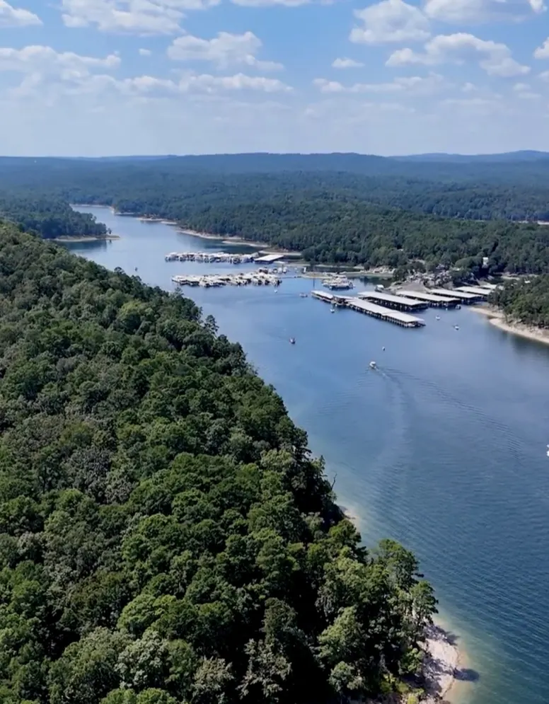
Broken Bow Lake is the big water at the heart of the area. It covers about 14,000 acres and reaches 22 miles back into the Ouachita Mountains. Near the dam it is more than 160 feet deep. Its many coves and clear water draw anglers, boaters and even scuba divers.
How the lake was made
The U.S. Army Corps of Engineers built the lake by damming the Mountain Fork River. Work began in October 1961, and the lake started filling in October 1968. It was full by 1970, the same year its two power units came online. The lake has five jobs: flood control, making electric power, water supply, recreation, and fish and wildlife. The earth dam is about 2,750 feet long and rises 225 feet above the riverbed.
Getting on the water
U.S. 259 runs along the west side of the lake. OK-259A loops off it at the south end and crosses the dam. Stop at the Corps' Overlook on OK-259A, west of the dam, to see the dam, the lake and the spillway.
Public areas on the lake include Stevens Gap, Carson Creek and Holly Creek, and the Corps counts eleven boat ramps. Stevens Gap has the lake's one marked swim beach, plus camping and the Lakeview Trail, with 1-, 3- and 5-mile options for hiking and biking.
Two more public areas sit below the lake. River Bend, below the spillway, has a swim beach too. Mountain Fork Park, below the dam, is an easy place to launch a canoe or kayak.
Anglers come for largemouth, smallmouth and spotted bass, plus crappie, catfish and walleye.
Our Broken Bow Lake visitor guide shows the current lake level, plus boat rentals, fishing guides and camping.
Mountain Fork River
The Mountain Fork River starts high in the Ouachita Mountains of Le Flore County, Oklahoma, inside the national forest. It loops east into Arkansas, then comes back into Oklahoma at the northeast corner of McCurtain County. It fills Broken Bow Lake, runs through Beavers Bend and joins the Little River about 6 miles south of Eagletown.
The upper river: a scenic float
Above the lake, the Upper Mountain Fork is one of six streams Oklahoma protects by law as scenic rivers. Most canoe trips run from Smithville down to the Narrows at the top of the lake. The rapids are small to medium, rated Class I to II+. Floats depend on rain, so trips are usually planned for early spring, summer and late autumn.
The lower river: trout country
Below the dam, cold water released from the lake keeps the Lower Mountain Fork cool enough for trout, even in an Oklahoma summer. The Oklahoma Department of Wildlife Conservation (ODWC) started the fishery in 1989 and stocks rainbow and brown trout all year. The trout area runs 12 miles, from the spillway down to the U.S. 70 bridge. About five miles of it are inside Beavers Bend. Oklahoma's state record brown trout, over 17 pounds, came from this river in 2005.
Before you cast:
- You need an Oklahoma fishing license. There is no separate trout license.
- Hooks must be barbless. Bait is allowed.
- Two zones have their own daily limits and trophy size rules, so read the current ODWC trout rules.
- A loud horn means the dam is letting out a lot of water, and the river may rise fast. Get out of the water.
- Clean and dry your waders and gear. A nuisance algae called didymo, or "rock snot," has been found here.
The lower river is also a popular canoe and kayak float from spring through fall. For trout tips and local guides, see the trout section of our Beavers Bend State Park visitor guide.
Ouachita Mountains & National Forest
The hills around the lake are the Ouachita Mountains. Say it "WASH-i-tah." The Forest Service says the name comes from the French spelling of a Native word meaning "good hunting ground."
The range runs from central Arkansas into southeast Oklahoma. Unlike many U.S. mountain ranges, these ridges run mostly east and west.
Ouachita National Forest
The Ouachita National Forest spreads over almost 1.8 million acres in two states. The Forest Service says no national forest in its Southern Region is older or bigger. President Theodore Roosevelt created the first part of it, in Arkansas, in 1907. The Oklahoma land was added later. Pine and hickory are the main trees, and there are more than 700 miles of trails.
McCurtain County has about 133,000 acres of national forest. The larger block, about 111,000 acres, lies north of Broken Bow around the lake and the Glover River. A smaller block sits southeast of Idabel. Not all the woods are public, though. About half the land inside the forest boundary in Oklahoma is private, so watch for signs.
Wild places nearby
At the north end of the lake, the McCurtain County Wilderness Area protects about 14,000 acres. The state set it aside in 1918. ODWC calls it the largest never-logged forest of shortleaf pine and hardwoods left in the nation. It is home to Oklahoma's last known red-cockaded woodpeckers, a rare bird that federal law protects as threatened. Most of it is closed without written permission, but a self-guided nature trail is open all year.
The Glover River flows its whole length inside McCurtain County. ODWC calls it one of the last rivers in the state with no dam on it. It has small, easy rapids, but in summer it is often too low to float.
For a long mountain drive, the 54-mile Talimena National Scenic Byway runs between Talihina, Oklahoma, and Mena, Arkansas. It is not in McCurtain County. Mena is about 70 road miles from Broken Bow.
For more outdoor ideas, see our Hochatown activities and attractions page.
Idabel & the rest of McCurtain County
Idabel is the county seat of McCurtain County. It had 6,961 people in the 2020 census. It is about 12 road miles south of Broken Bow.
How Idabel got its name
Idabel began in 1902 as a railroad town called Purnell, after railroad official Isaac Purnell. Postal officials turned that name down. So the post office opened as Bokhoma, Choctaw for "Red River." Railroad officials then joined the names of Purnell's daughters, Ida and Bell. The post office became Idabel in 1904.
Museum of the Red River
The Museum of the Red River in Idabel has been free since 1974. It shows art and objects from long ago, from many lands, with a focus on Native American peoples. Look for the cast of Acrocanthosaurus atokensis ("Acro" for short), Oklahoma's state dinosaur, a meat-eater nearly 40 feet long. The most complete skeleton ever found was dug up in 1983, less than 20 miles from the museum. It is closed Mondays and national holidays.
Wetlands and birds
South of Idabel near Haworth, Red Slough Wildlife Management Area has about 2,400 acres of wetlands. More than 300 bird species have been seen there. Bald eagles are seen often, and alligators turn up now and then.
Eagletown
Eagletown is about 11 miles east of Broken Bow on U.S. 70, near the Mountain Fork River. It was one of the first places Choctaw families made homes after the forced removal. About 3 miles west of town stands the Jefferson Gardner House. Work on it began in 1884, and it is listed on the National Register of Historic Places. Gardner served as Principal Chief of the Choctaw Nation from 1894 to 1896.
The Choctaw Nation
McCurtain County lies inside the Choctaw Nation Reservation. The Treaty of Dancing Rabbit Creek, signed in 1830, began the forced removal of the Choctaw people from Mississippi and Alabama. From 1831 to 1833, about 15,000 Choctaw people were forced west. As many as one in three died on the way. The Choctaw Nation calls it the "Trail of Tears and Death."
The county is named for the McCurtain family. Three McCurtains served as principal chiefs. Even the name "Oklahoma" is Choctaw. Okla means "people" and humma means "red." Near Millerton, Wheelock Academy Historic Site is where Choctaw students went to school and lived from 1832 to 1955. It is a National Historic Landmark.
Find places to eat in the county seat on our Idabel restaurants page.
Getting here
Hochatown's town plan says the lake and the state park draw visitors from across Oklahoma, Arkansas and Texas. Road miles and drive times to Broken Bow below assume no traffic and no stops, so plan on a little longer.
- Dallas: about 183 miles, about 3½ hours
- Fort Worth: about 215 miles, about 4 hours
- Oklahoma City: about 251 miles, about 4½ hours
- Tulsa: about 214 miles, about 4 hours
- Shreveport: about 153 miles, about 3 hours
- Little Rock: about 168 miles, about 3 hours 20 minutes
- Texarkana: about 79 miles, about 1 hour 45 minutes
From Dallas and Fort Worth, one fast route heads to Hugo, then east on U.S. 70 through Idabel. From Texarkana, Shreveport or Little Rock, drive to De Queen, Arkansas, and take U.S. 70 west. From Oklahoma City or Tulsa, take the Indian Nation Turnpike south to Hugo, then U.S. 70 east.
Once you're here, Hochatown is about 9 miles north of Broken Bow on U.S. 259, and Beavers Bend is about 10 miles. Idabel is about 12 miles south. Eagletown is about 11 miles east.
When to visit
The weather numbers below are NOAA's 1991-2020 averages for the Broken Bow and Idabel weather stations.
- Spring: April averages a high near 74°F and a low near 48°F. Spring rain helps floats on the upper Mountain Fork. May is the wettest month.
- Summer: It gets hot. July and August highs average about 93°F. This is lake season. Swim at Stevens Gap on the lake or at River Bend below the spillway. The trout water below the dam stays cold.
- Fall: October averages a high near 77°F. Fall color usually peaks from late October into mid-November. Pine and hickory fill these woods, so the colors lean gold and rust, with less red. The free Beavers Bend Folk Festival & Craft Show is held at the Forest Heritage Center in November (November 13-15 in 2026).
- Winter: Winters are mild. January lows average about 29°F, and snow is light, about 2 inches a year. Bald eagles winter on the lake and the Mountain Fork. You may spot eagles as soon as November, and the most show up in January and February. Your odds are better at the start of the day and in late afternoon.
The Broken Bow station gets about 55 inches of rain a year, so pack a rain jacket in any season.
Start planning your trip
Ready to go? Our Business Directory lists local places to eat, stay, shop and play, with hours, photos and directions. Check the events calendar to see what's on while you're here. And browse all of our visitor guides for more trip ideas.